本文属于机器翻译版本。若本译文内容与英语原文存在差异,则一律以英文原文为准。
标准地图样式
标准地图样式是一种简洁而现代的通用地图设计,可以无缝适配几乎任何应用程序或网站。
颜色方案
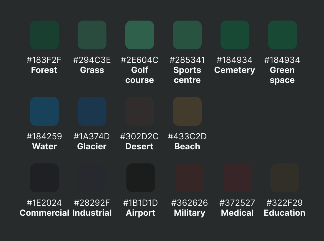
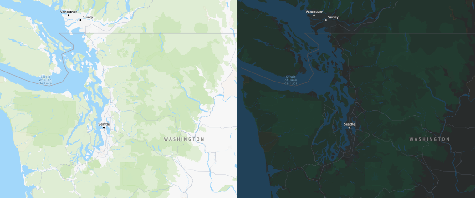
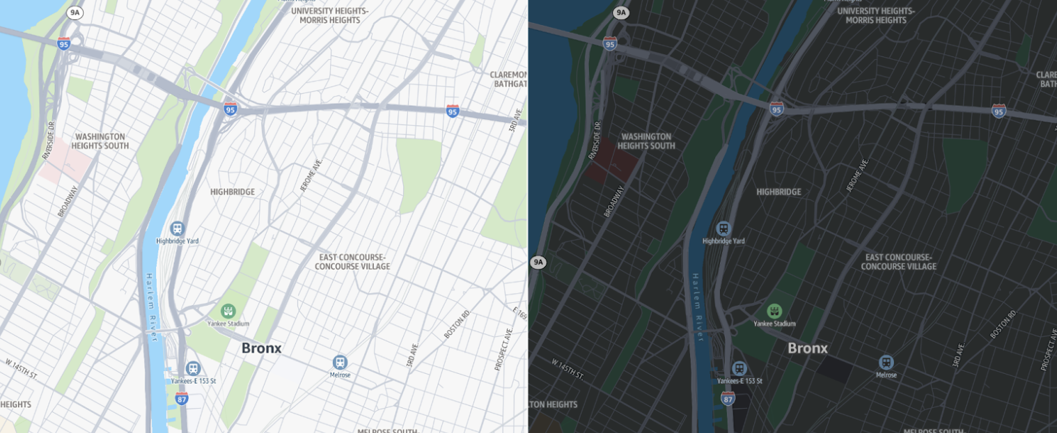
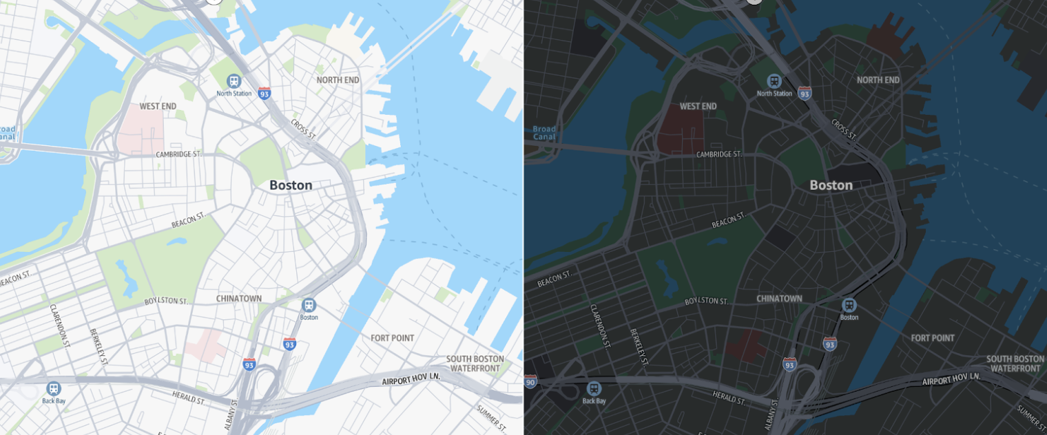
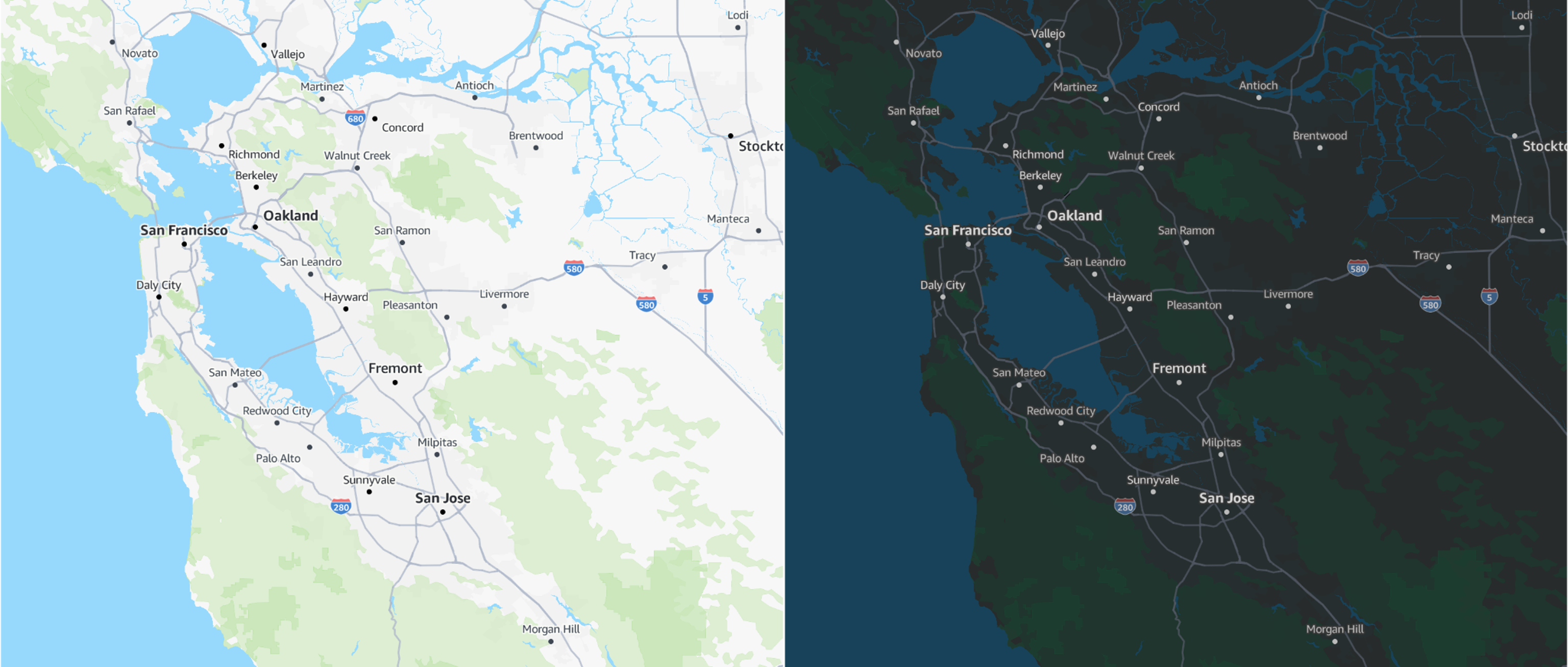
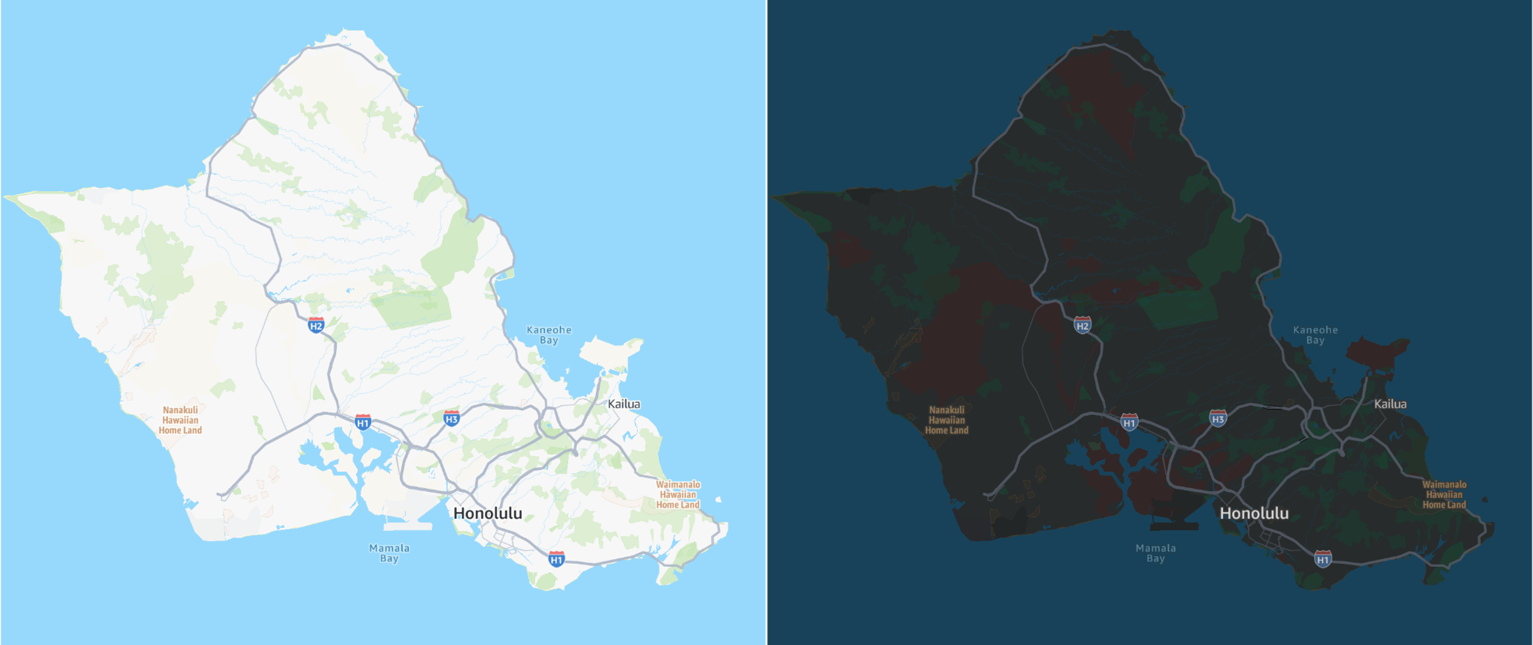
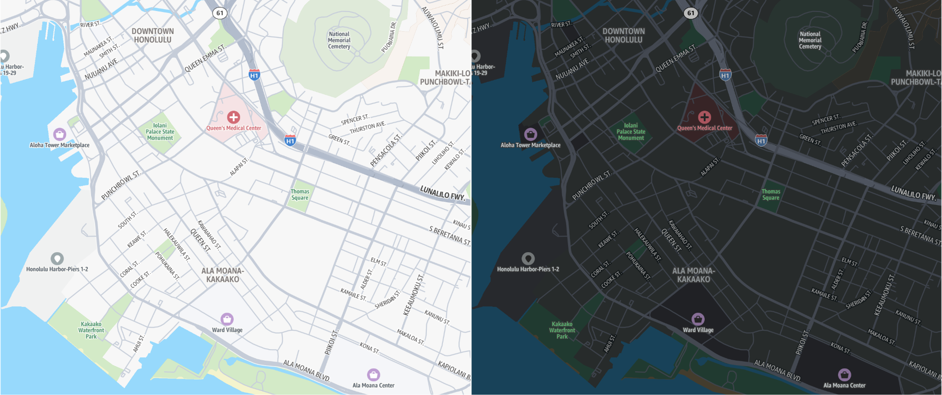
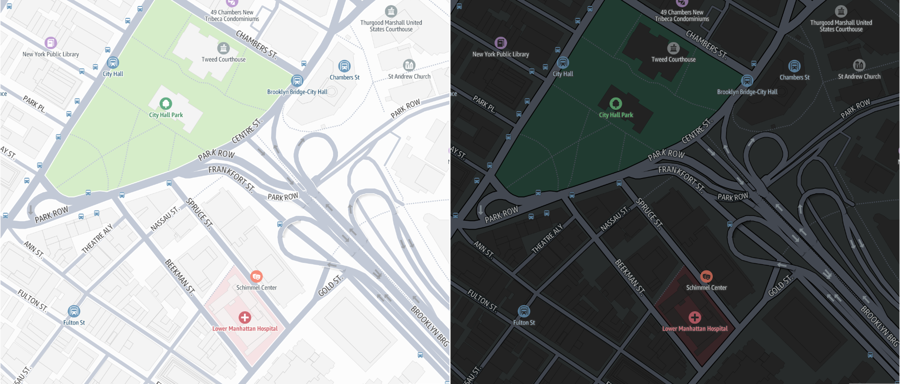
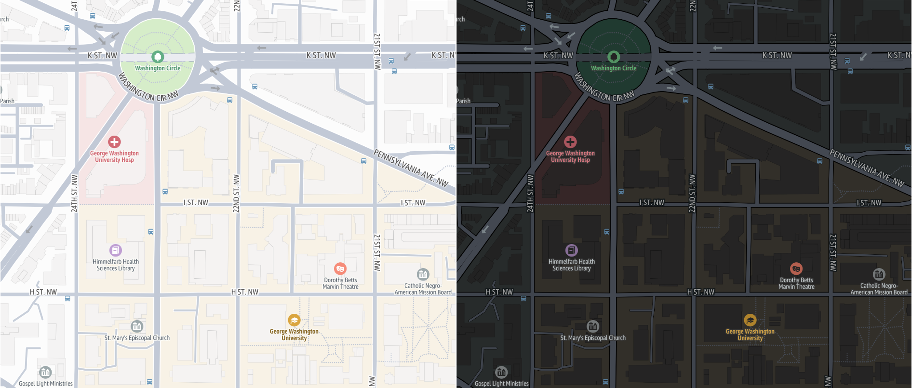
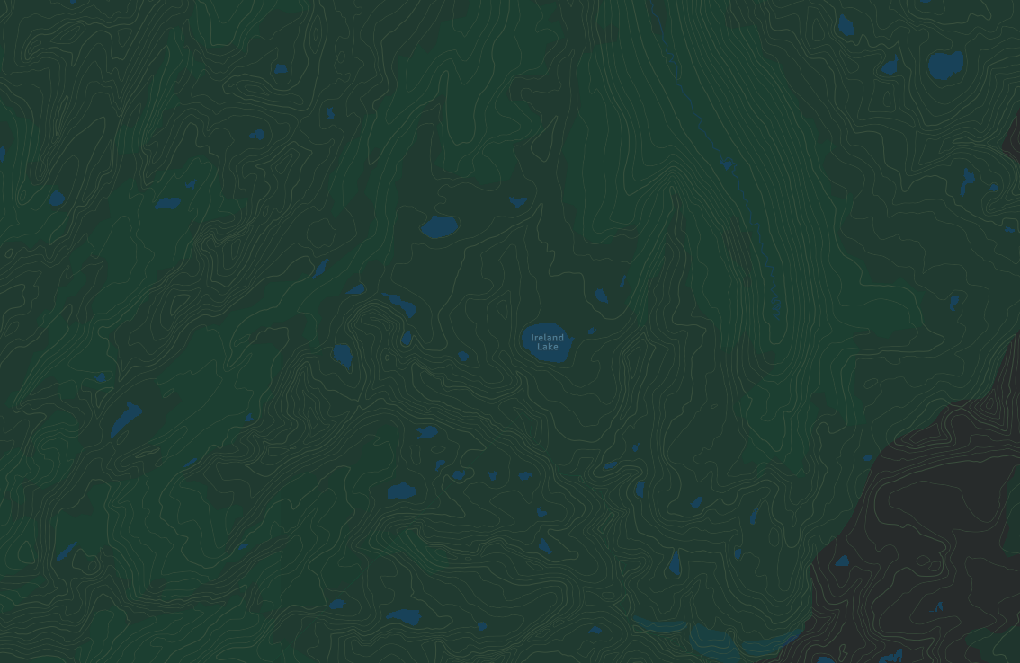
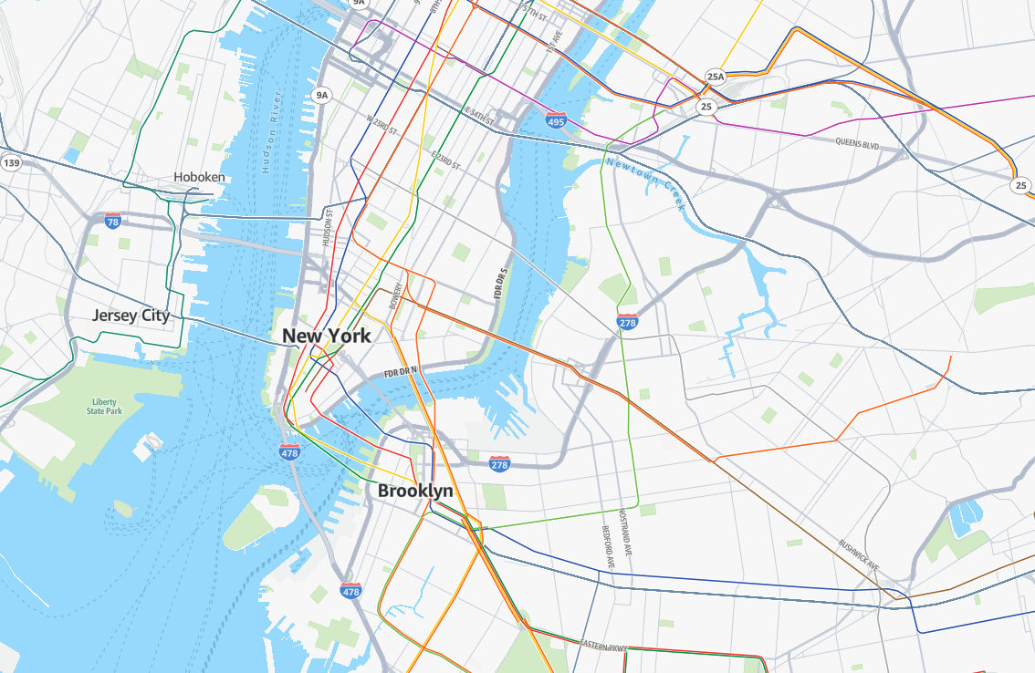
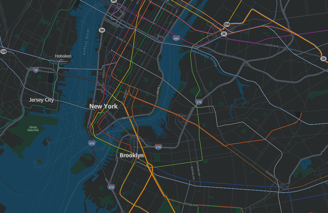
标准地图样式有浅色和深色两种模式。浅色模式用途广泛,可以适应任何环境;而深色模式则采用有限的色彩搭配,旨在清晰地展现细节并在较暗的环境中保持可读性。这样可以尽可能地减少干扰,尤其适用于夜间导航等场景。
令人愉悦、充满现代感的色彩搭配
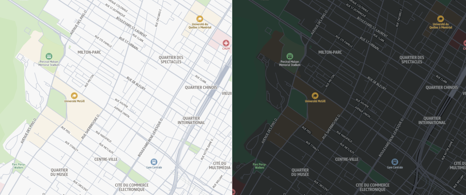
柔和的色彩为地图提供了重要的土地利用背景信息,同时又不会使地图显得过于繁杂,在高倍和低倍放大模式下都能提供有用的信息。进行缩小显示时,森林、沙漠和冰川等特征为地图增添了丰富的细节。进行放大显示时,一系列颜色会突出显示诸如学校、医院、休闲区(如公园和体育设施)以及城市区域(如商业区和工业区)等重要地标。
整体样式采用统一的色彩搭配,包括与各自土地利用区域相匹配的 POI 标记。道路网络以灰色阴影呈现,既提供了细节,又不会因鲜艳、引人注目的色彩而使地图显得过于繁杂。
丰富的兴趣点(POI)
标准地图样式支持丰富的可配置兴趣点(POI)。只需几行代码,即可选择与您的使用案例相关的 POI 类别。

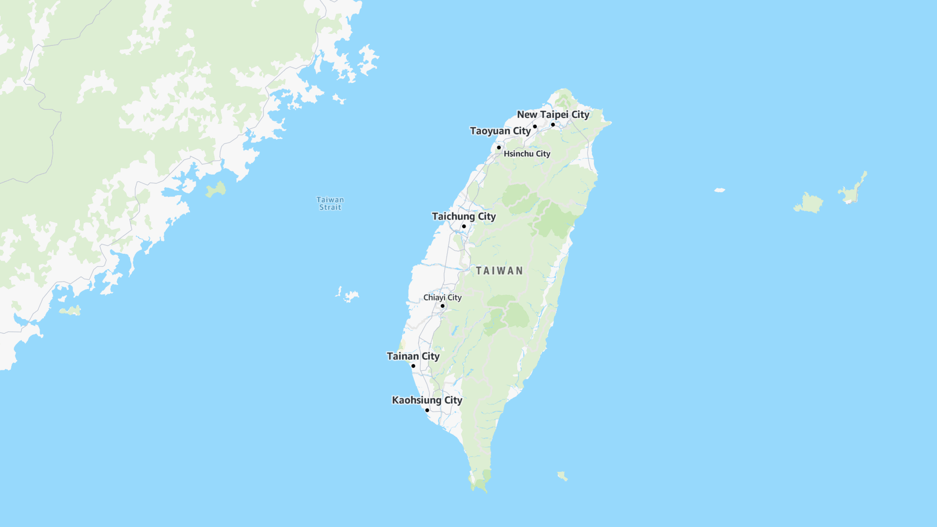
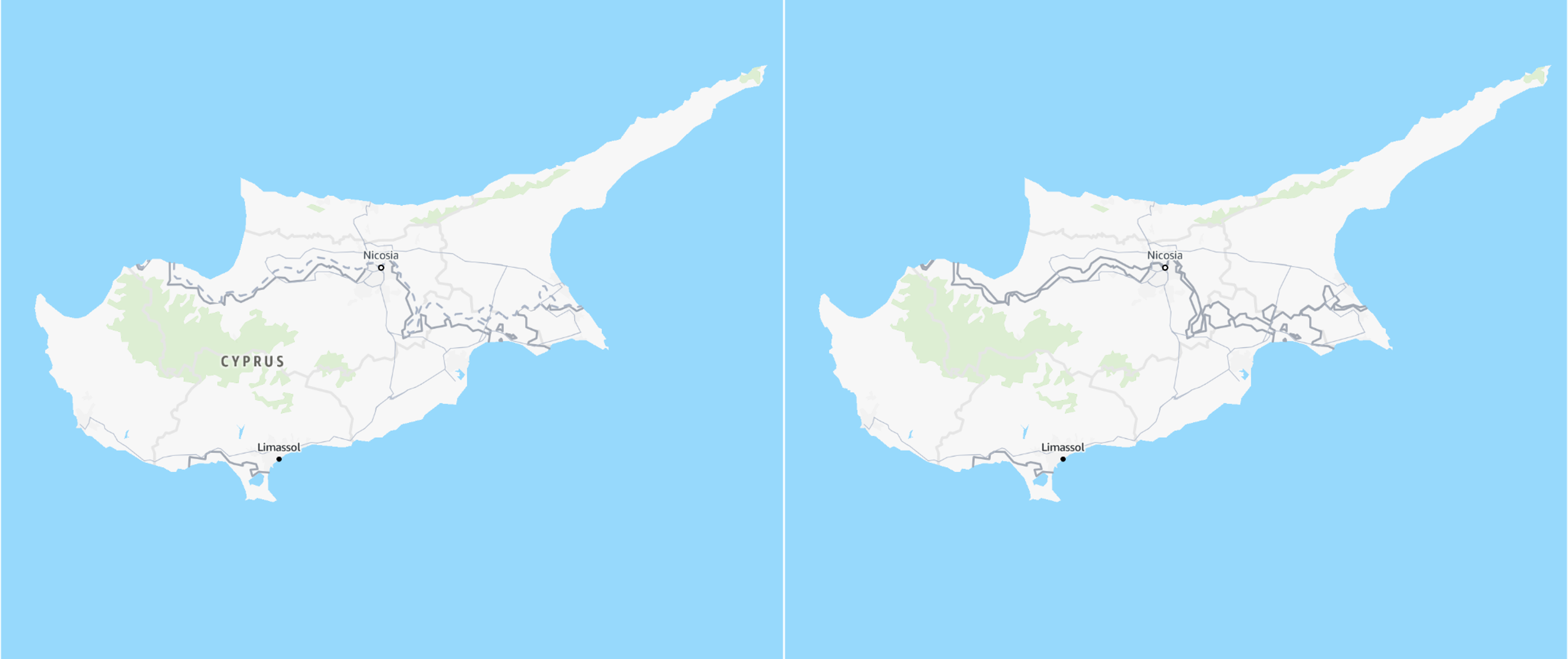
面向全球市场而设计
标准样式支持不同的政治观点,可确保地图为您的用户显示正确的边界。该样式还便于在地图标签上轻松切换不同的语言,它支持数十种语言和书写系统。
要了解更多信息,请参阅本地化和国际化。
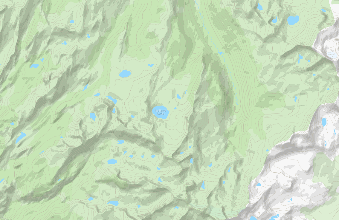
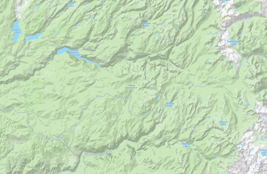
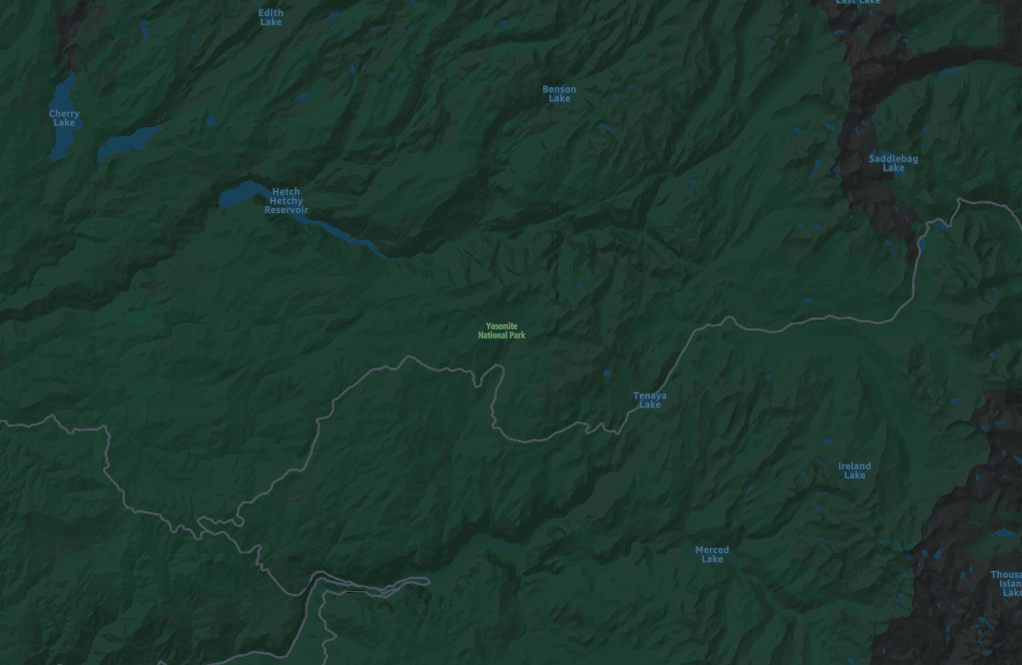
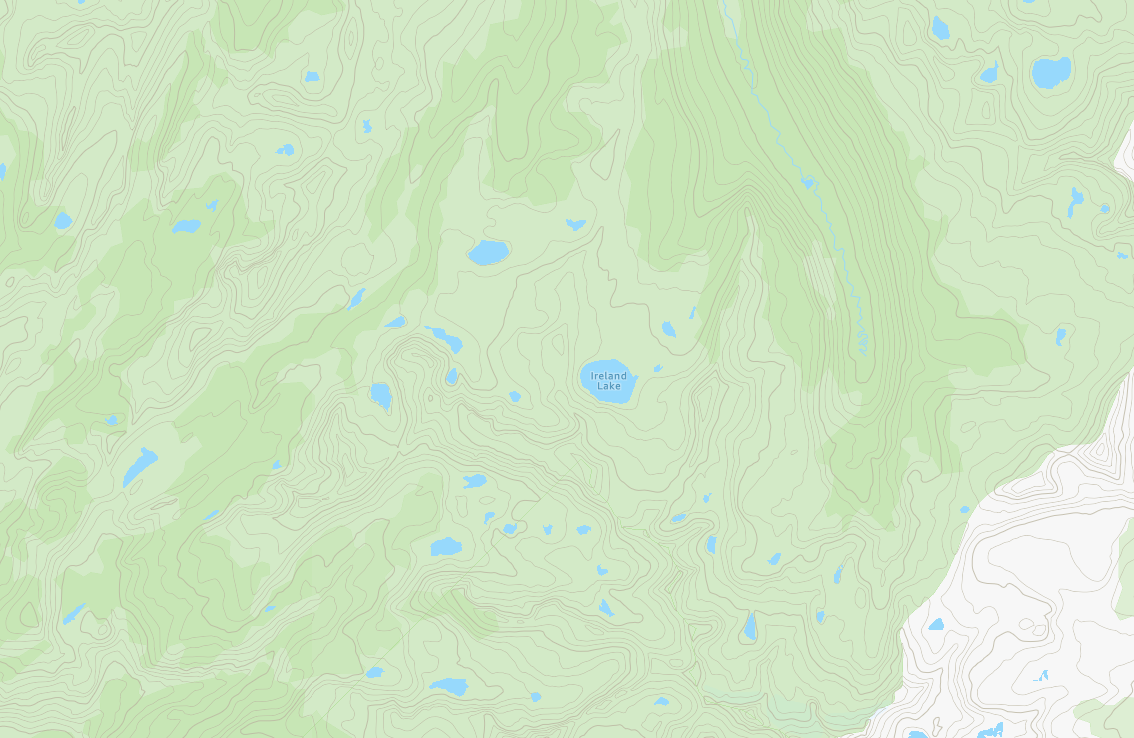
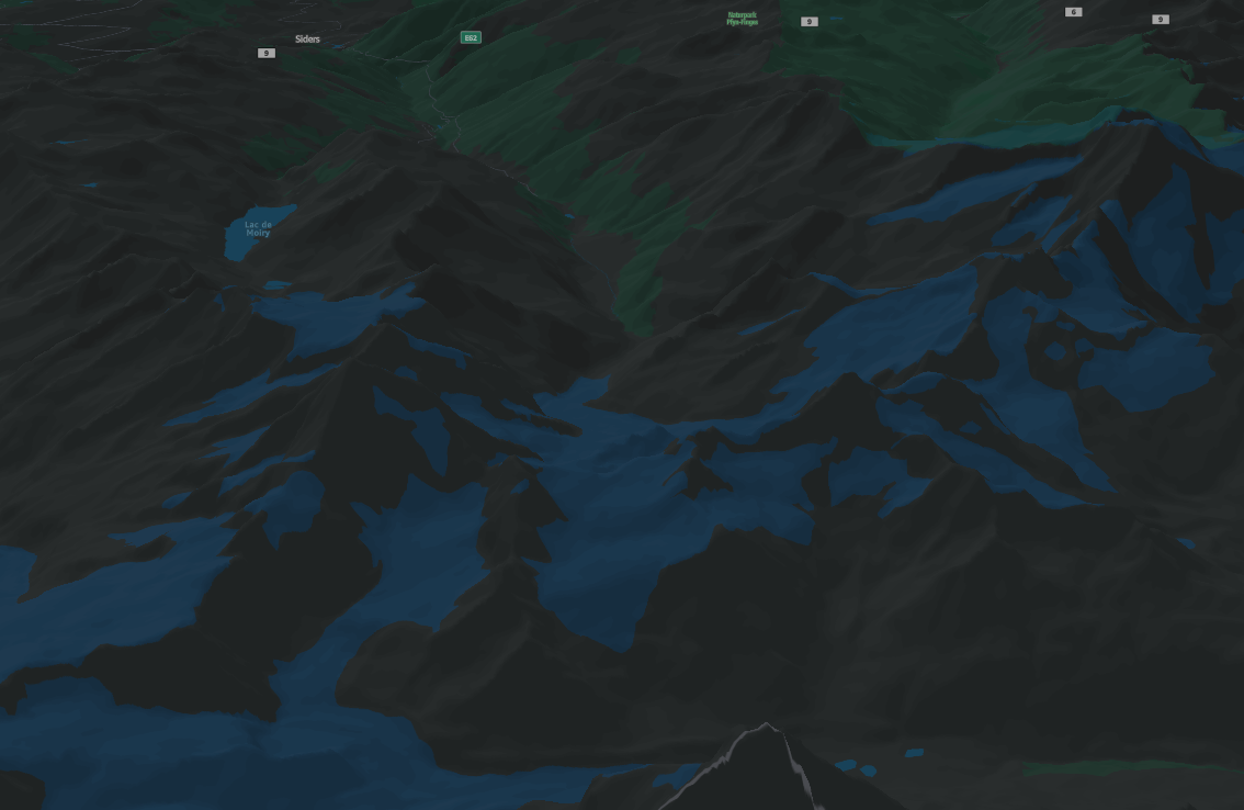
地形
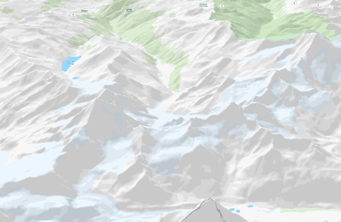
标准地图样式提供了详细的地形可视化,突出显示了海拔变化和自然地理特征。等高线、阴影和地形纹理可以真实地呈现景观,使用户能够轻松解释斜坡、山谷和山峰。这种地形渲染非常适合户外规划、环境分析和应用,在这些应用中,了解地形特征可以增强决策和空间意识。

导航
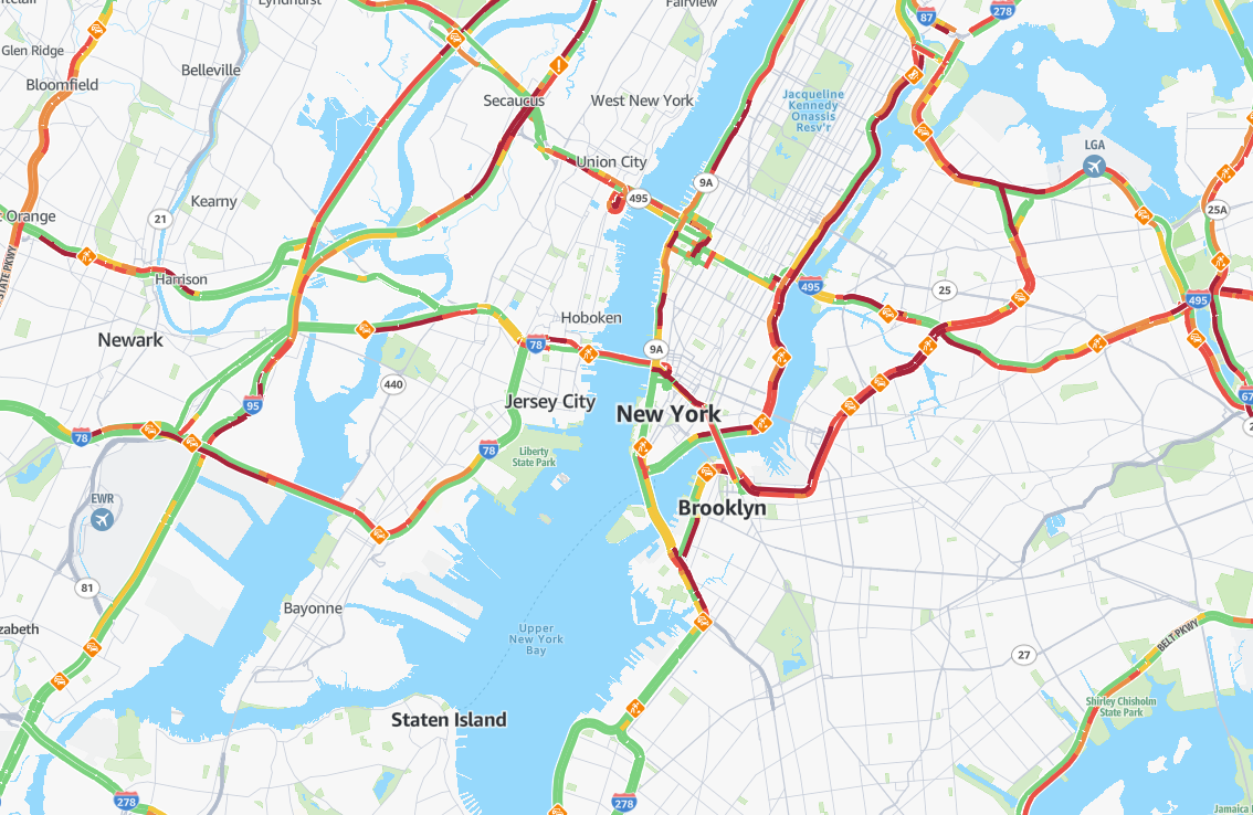
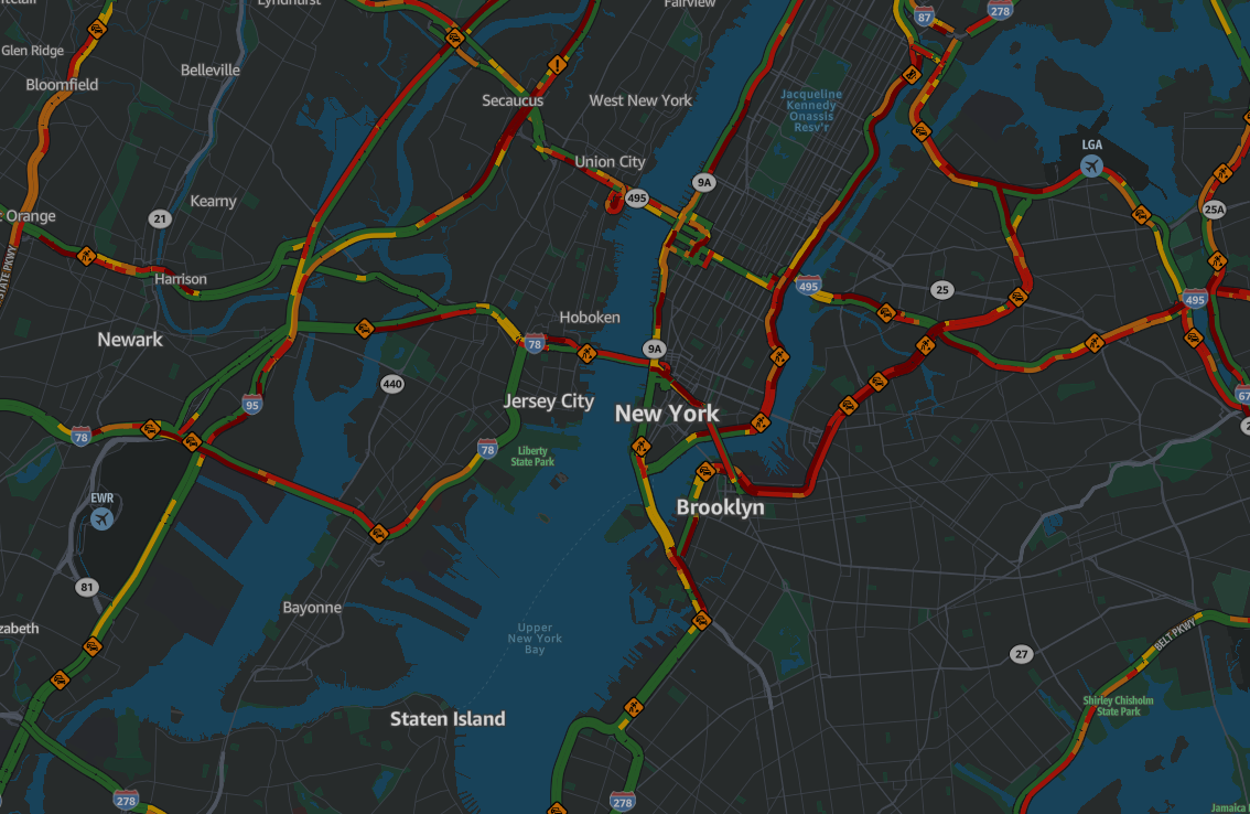
标准地图样式提供了用于提供动态可视化的选项,旨在优化导航和路线规划。实时交通数据突出显示拥堵、事故和路况,使用户能够预测延误并相应地调整路线。在多种出行模式(例如卡车或公共交通)中,该功能使用户能够为自己的路线选择最高效、最适合情境的选项,从而确保更流畅、更明智的路线体验。


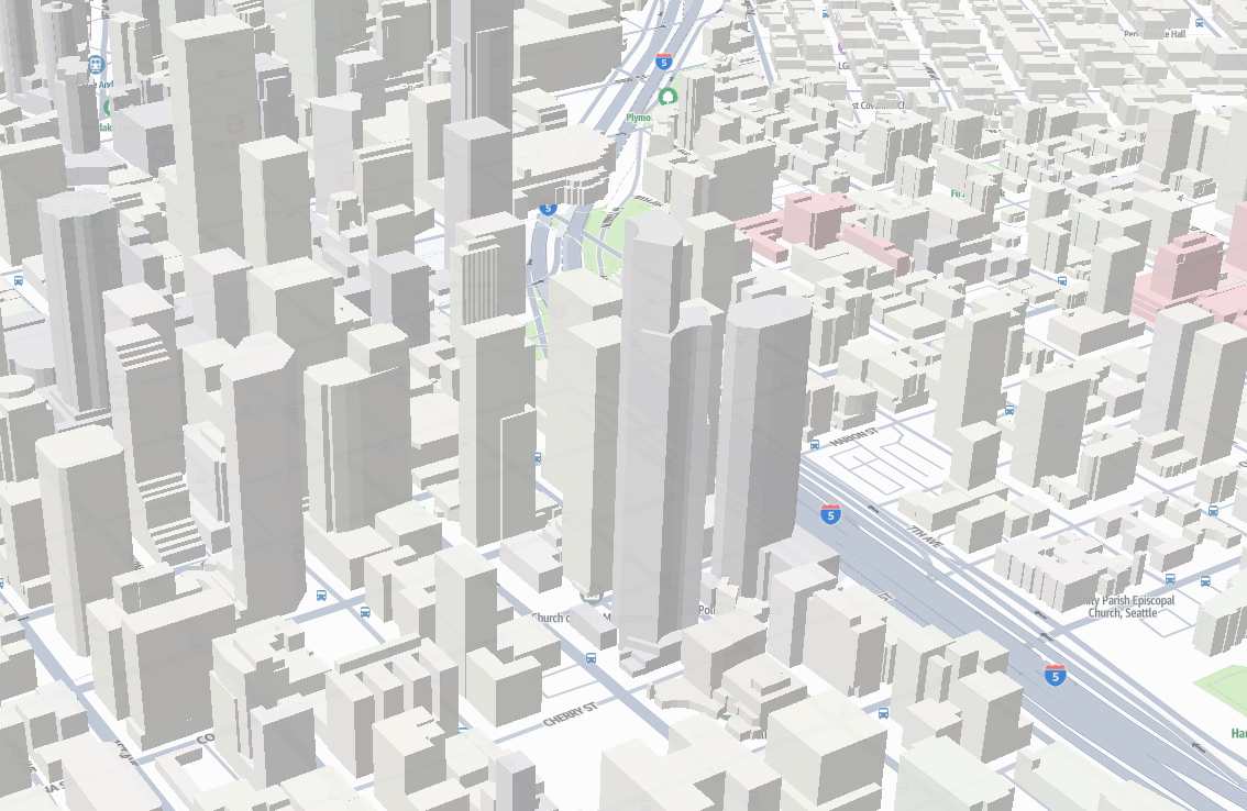
3D
标准地图样式提供身临其境的三维可视化效果,以空间深度和视角呈现地形高程和建筑结构。可调节的视角、俯仰控制和三维渲染可以真实地呈现自然景观和城市环境,使用户能够轻松解释海拔变化、地形复杂性和空间关系。这种三维渲染非常适合路线规划、城市导航和应用,在这些应用中,了解垂直尺寸和深度感知可以增强决策和空间意识。

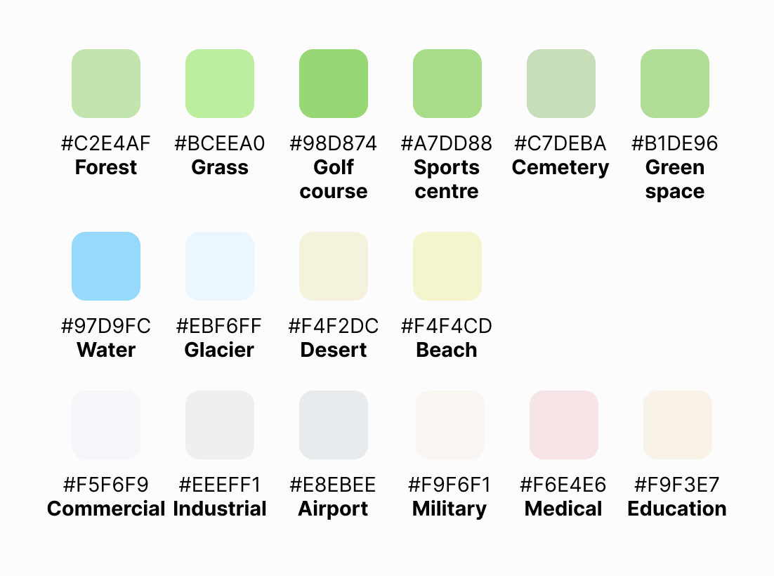
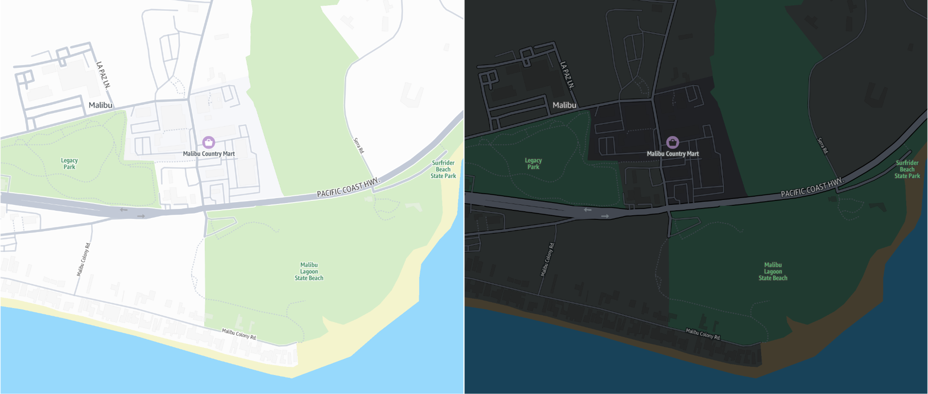
土地利用
标准地图样式使用鲜艳的色彩来表示指定的土地用途。绿色代表森林、草地、高尔夫球场、体育中心和公园。相关颜色用于描绘水体、冰川、沙漠和海滩。此外,诸如商业区、工业区、机场、军事区、医疗设施和教育区域等土地用途都通过特定鲜明的类别进行了突出展示。